

The Antietam Institute offers two digital map products: the Antietam Base Map and the new 14-map Carman-Cope Map Atlas.
Both the base map and the Carmen-Cope maps are available to purchase and download to your phone through Avenza – a digital mapping app for your smartphone or other device.
Peruse the maps on and off the field, and by using GPS, you can immerse yourself on the landscape of the battlefield. Simply download the free Avenza app to your smartphone or tablet and create a free account. Then search the Avenza store for the Antietam Institute maps and purchase the base map for $1.99 and the 14-map set for only $14.99!
Avenza for Google Android devices
Avenza for Apple iOS devices
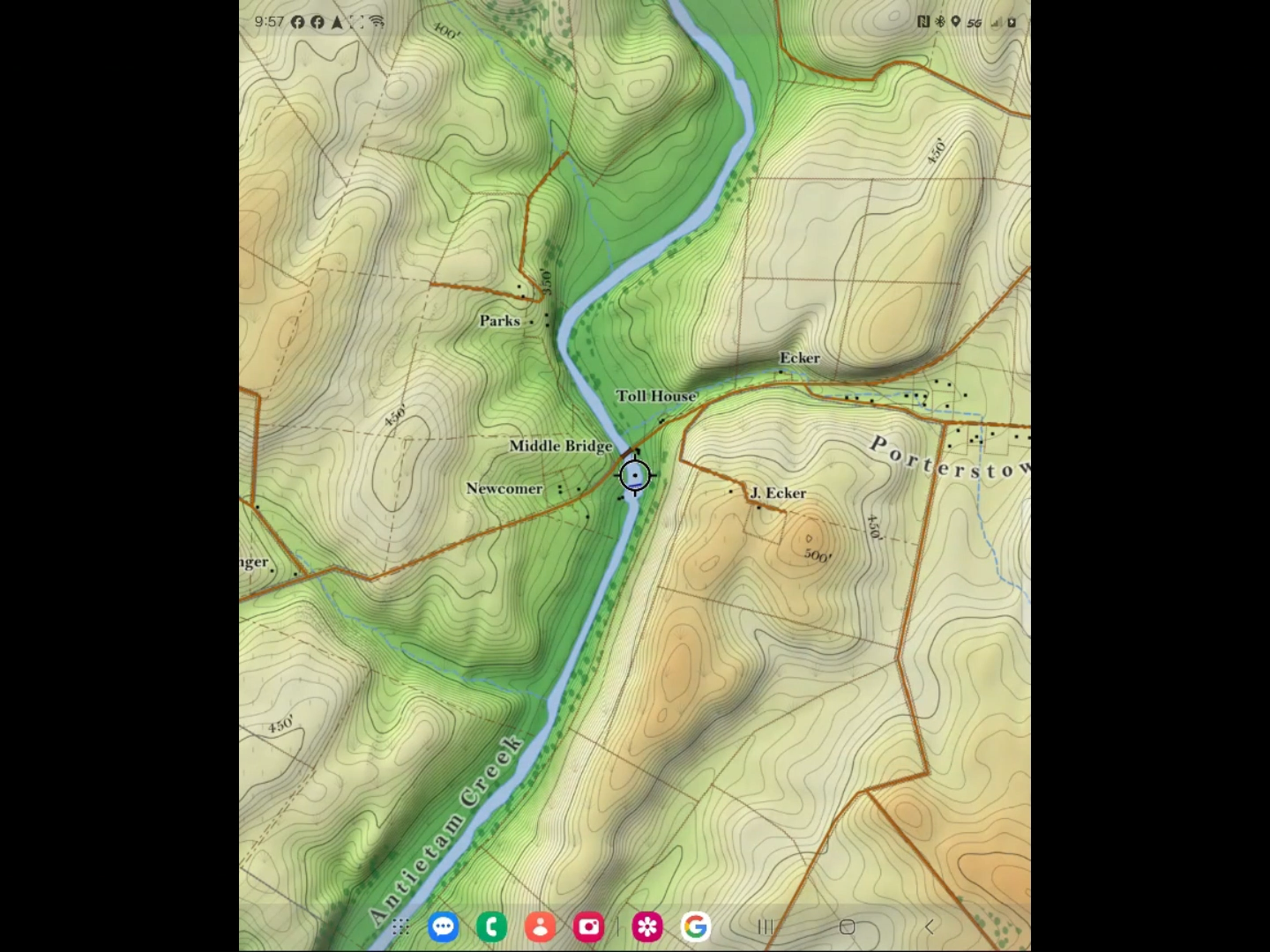
A view of part of the base map on a smartphone
You can load the maps on more than one device: once you have an account, you can download the maps you have already purchased onto additional devices.
The history of the maps
War Department maps were created as part of the excellent work of the Antietam Battlefield Board in the 1890s. A set of 14 maps covering the various time periods of the fighting during the day on the 17th, these are known as the Carman-Cope Maps. They are named for two of the men most responsible for their creation: General (formerly Colonel) of Volunteers Ezra Carman, a member of the Board who ascertained the positions and movements of units, and Lieutenant Colonel Emmor B. Cope, the engineer who surveyed the ground.
These maps were published by the US Government Printing Office (GPO) in 1904 as the Atlas of the Battlefield of Antietam, and are are available in their original form online from the Library of Congress. They were revised and re-issued in 1908; that version also online from the Library of Congress.
Through remote and field-based work, Institute experts matched 60 locations between the Carman-Cope maps and actual locations on the ground to give these classic maps modern GPS usage while preserving their timeless aesthetic.
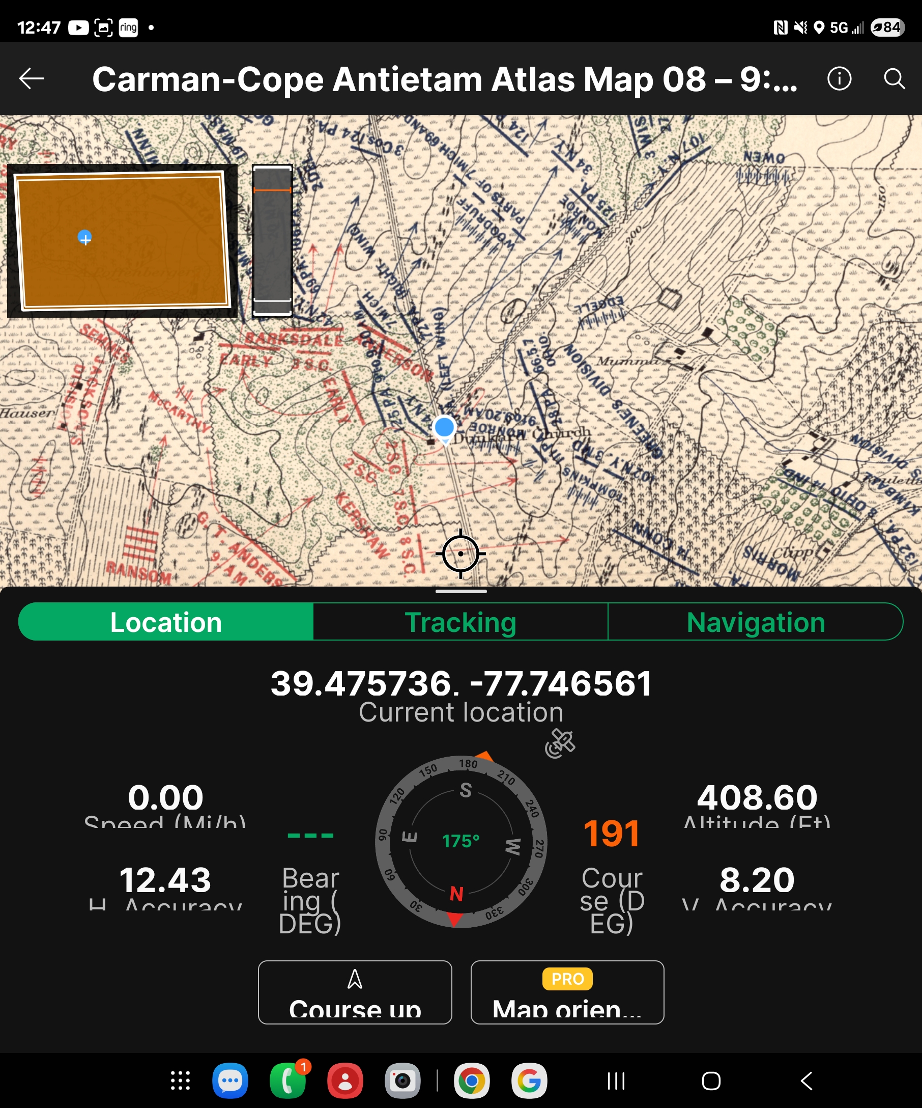
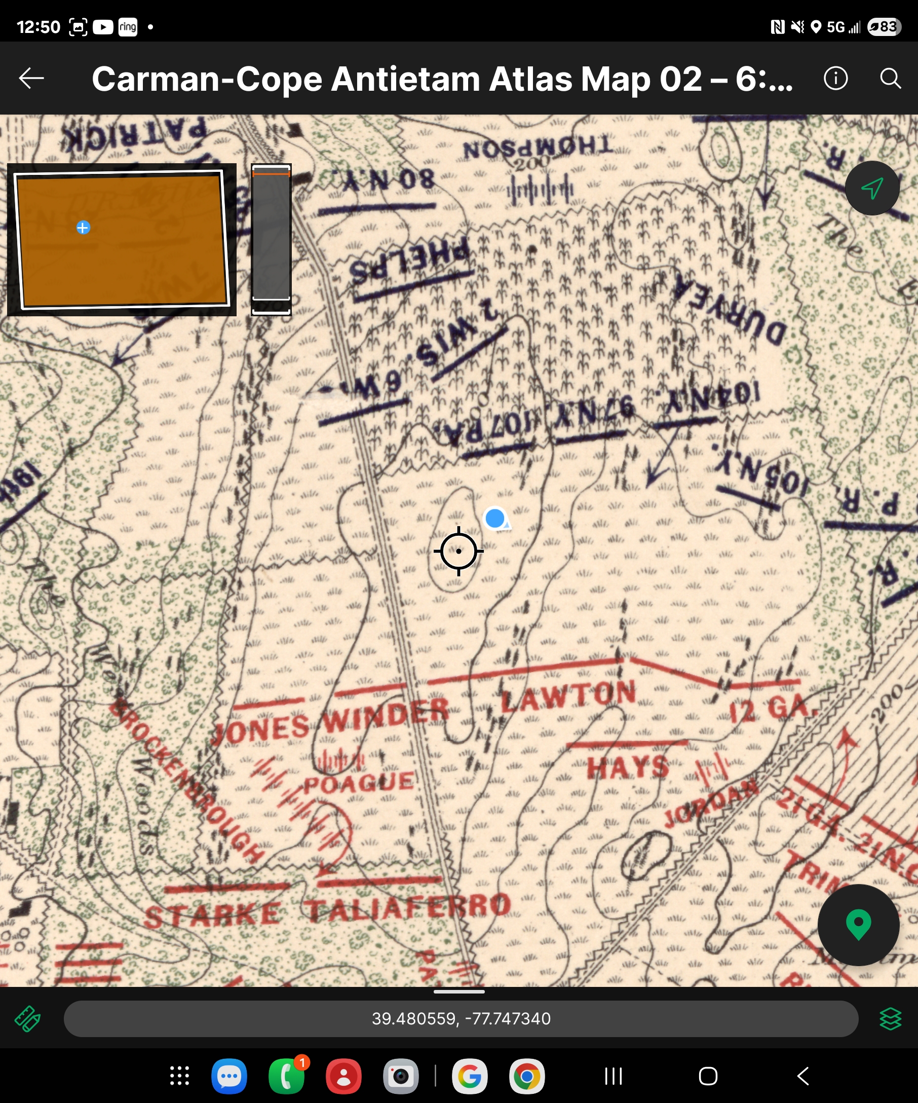
Views of two of the 14 maps of the Atlas as seen on a smartphone on the Antietam National Battlefield. Above, near the Dunker Church (9am, 17 September 1862) with navigation dashboard open. Below, near the Miller Cornfield (6am) .
Now you can use these digital maps on the Antietam battlefield as you drive the park roads, walk the trails, or trek on one of our excursions to see exactly where you are on the field as compared to the units and terrain on all fourteen maps.