

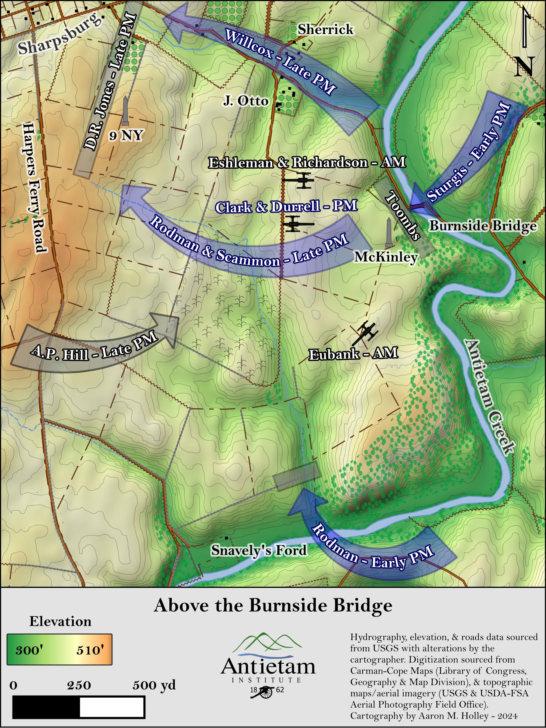
Antietam Journal, Vol. 7, Fall 2024. J. O. Smith, "In Antietam’s Footsteps: Above the Burnside Bridge" Map
- Type - map
- Battlefield map
- Title - caption or label given by the creator
-
Antietam Journal, Vol. 7, Fall 2024. J. O. Smith, "In Antietam’s Footsteps: Above the Burnside Bridge" Map
- Creator - cartographer/artist
- Holley, Aaron M
- Date Created
- September 2024
- Spatial Coverage - the place depicted (geographical location)
- Antietam Battlefield
- Publisher
- Antietam Institute, Sharpsburg, Maryland
- Rights - a statement of any use restrictions or ownership
- This item is protected by copyright and/or related rights. You are free to use it in any way that is permitted by the copyright and related rights legislation that applies to your use. For other uses you need to obtain permission from the rights-holder(s). We make the item available with specific permission of the copyright holder. You are responsible for your own use.
- Source - owner or repository of original or digital image
- Historical Research Center, Antietam Institute
- Description - notes, provenance, or other information about the map
-
- Map depicting action in and around the Burnside Bridge and the Final Attack south of Sharpsburg on 17 Sept. 1862.
- Hydrography, elevation, and roads data sourced from USGS with alterations by the cartographer.
- Digitization sources from the Carman-Cope Maps (Library of Congress, Geography & Map Division), and topographic maps/aerial imagery (USGS & USDA-FSA Aerial Photography Field Office).
Position: 667 (135 views)