

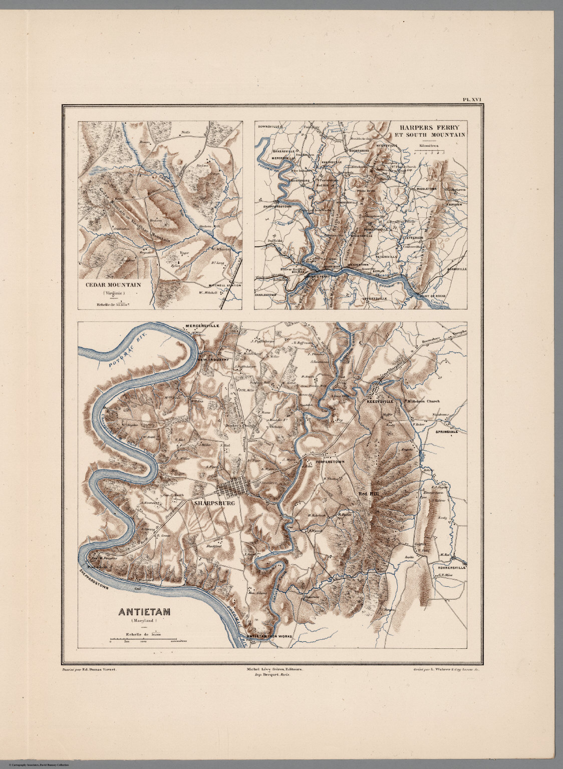
Planche XVI. Antietam (Maryland). Cedar Mountain (Virginie). Harpers Ferry et South Mountain. Dessine par Ed. Dumas Vorzet. Michel Levy, freres. Editeurs. Imp. Becquet, Paris. Grave par L. Wuhrer, R. Gay-Lussac 52.
- Type - map
- Map
- Title - caption or label given by the creator
- Planche XVI. Antietam (Maryland). Cedar Mountain (Virginie). Harpers Ferry et South Mountain. Dessine par Ed. Dumas Vorzet. Michel Levy, freres. Editeurs. Imp. Becquet, Paris. Grave par L. Wuhrer, R. Gay-Lussac 52.
- Creator - cartographer/artist
- Vorzet, Ed.Dumas; Le Comte de Paris; Michel Levy, freres
- Date Created
- 1875
- Spatial Coverage - the place depicted (geographical location)
- Antietam Creek
- Publisher
- Michel Levy Freres
- Rights - a statement of any use restrictions or ownership
-
This item is in the Public Domain under the laws of the United States because copyright has expired, but we have not determined its copyright status under the copyright laws of other countries. You are responsible for your own use. - Description - notes, provenance, or other information about the map
- Maps were made by Vorzet to accompany Louis Phillipe d'Orleans' (Comte de Paris) multivolume "Histoire de la Guerre Civile en Amérique". The set includes two (of three) of the original fascicle covers (this was issued in parts, and often bound later). The first fascicle was from 1874. The fascicles were issued to accompany vols. 1-2, 3-4. and 5-6 respectively of the "Histoire." The Comte de Paris was a pretender to the throne of France, and expatriate, working as an aide-de-camp to the Union Gen. George MacClellan (McClellan). He eventually settled in England. Pub Date is the latest date of the maps published over time for this series. Looseleaf in two (of the original three) paper light green fascicles. Maps are color; chromolithographs. The atlas was provided for digitization by Joel Kovarsky, and has since been donated to the Albert and Shirley Small Special Collections Library of the University of Virginia.
Position: 79 (294 views)